HOME
Tikal (Petén, Guatemala) - A Major Mayan city
and UNESCO world heritage site
"Plaza Mayor"

© Stéphane Guisard, Los Cielos de Los Mayas
Credit: Stéphane Guisard / IDAEH-Tikal
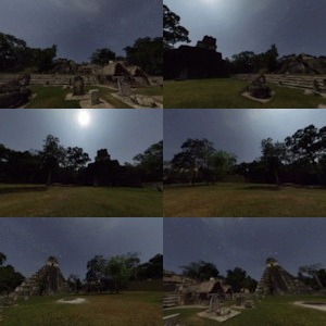
Tikal (or Tik'al according to the modern Mayan orthography) is one of the largest archaeological sites and urban centres of the pre-Columbian Maya civilization. It is located in the archaeological region of the Petén Basin in what is now northern Guatemala. Situated in the department of El Petén, the site is part of Guatemala's Tikal National Park and in 1979 it was declared a UNESCO World Heritage Site. The following set of pictures and animations shows the "Plaza Mayor". The Great Plaza lies at the core of the site; it is flanked on the east and west sides by two great temple-pyramids:
-Temple1 (also known as the "Temple of the Great Jaguar") is the one better lit by the Moonlight on this picture. The structure is a funerary temple associated with Jasaw Chan K'awiil I, a Classic Period ruler of the polity based at Tikal, who ruled from AD 682–734. The temple rises 47 meters (154 ft) over the Great Plaza. Text from Wikipedia.
-Temple2 (also known as the "Temple of the masks") is in the shadow of the Moonlight. The pyramid is a squat, massive structure dating to the 8th century AD. Today it stands 38 metres (125 ft) high and is the most thoroughly restored of the major temples at Tikal. Text from Wikipedia.
On the North, the Great Plaza is bordered by the North Acropolis and on the South by the Central Acropolis.
Deseo expresar mis mas profundos agradecimientos al Ministro de Cultura de Guatemala, al INGUAT, al IDAEH y Parque Nacional Tikal por haber hecho posible este trabajo. Agradezco también sinceramente a Adriana, Federico, Fredy y Victor por su ayuda en la preparación y el buen desarrollo de este proyecto.


Virtual reality tour of Tikal Plaza Mayor. Click on the symbols in the window(GO FULLSCREEN BY CLICKING the arrowed 'X' on animation) or use arrow Keys or click & drag mouse to move Left/Right/Up/Down, Shift/Ctrl Keys or mouse wheel to zoom In/Out ....... have a nice trip !!
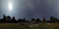
360 degrees panorama view of Plaza Mayor. Temple 2 is on the left, below the Moon that illuminates temple 1 on the right. The North Acropolis lies in the middle of the image.
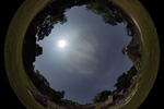
Fisheye view of Plaza Mayor under the Moonlight.